hello,
I'm teaching kids at elementary school in South Korea.
I demonstrated I-tree tool to explain benefit of tree to my students.
At the end of class, one of students asked me this questions.
" How to calculate tree benefit zone area? which equation (algorithm) they use to find that? "
Unfortunately, I had no idea about that. I promised that I will tell him next time...
I'm searching for the answer, but I can't...
I wish somebody can help me to answer this..
how to calculate tree benefit zone?
Moderators: i-Tree Support, i-Tree Team
-
brandoncha
- Posts: 1
- Joined: Sun Jul 28, 2019 2:05 am
-
Jason.Henning
- i-Tree Team
- Posts: 341
- Joined: Fri Dec 21, 2012 7:45 am
Re: how to calculate tree benefit zone?
Thanks for your question.
The i-Tree energy methods drive most of those benefits zone maps and are explained in broad strokes here, http://www.itreetools.org/streets/resou ... st_CTG.pdf (see around page 5 for the energy overview) and this is one of the more specific papers that work draws on, https://www.nrs.fs.fed.us/pubs/jrnl/198 ... er_002.pdf.
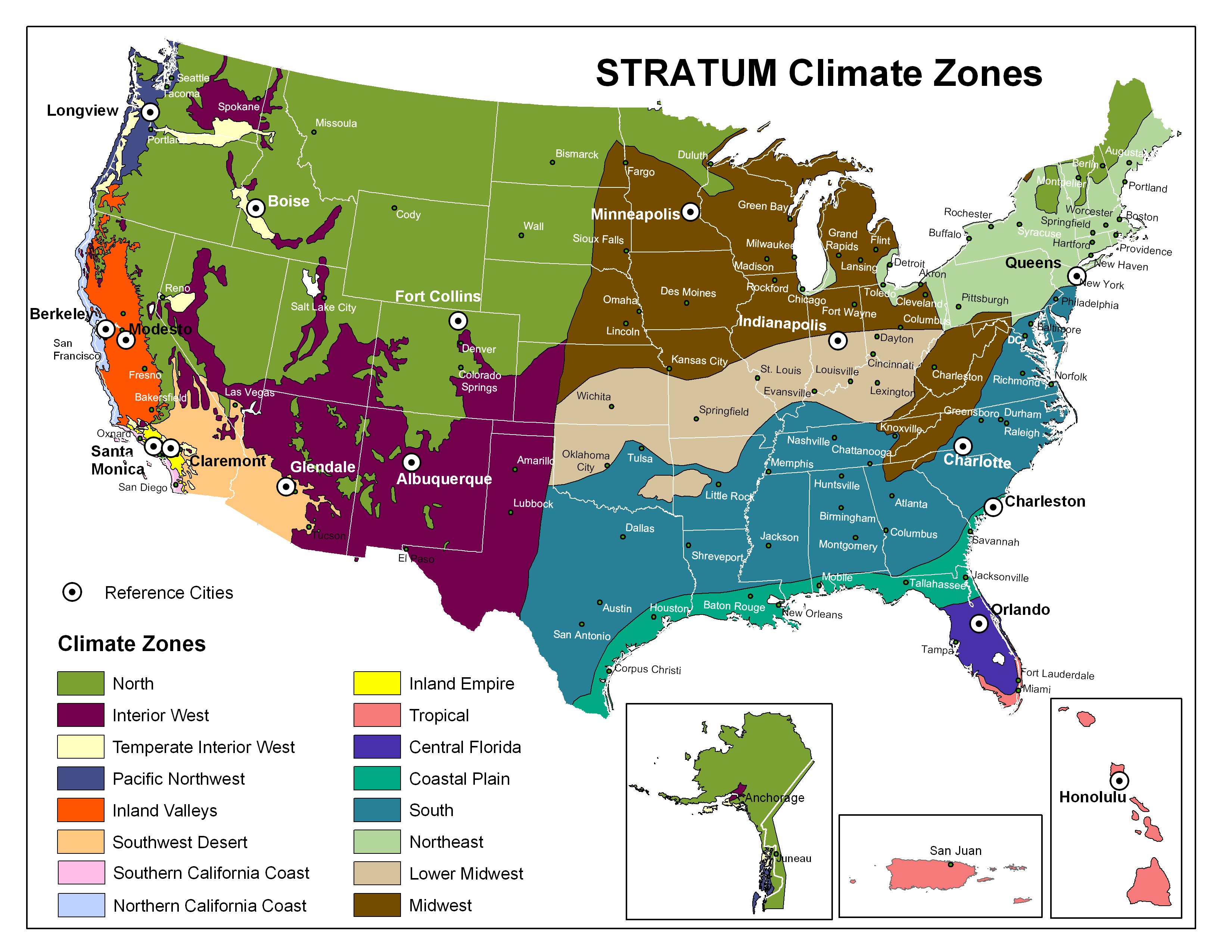
The energy models differ for different regions of the US. Things like predominant wind direction, seasonal sun angle, relative local heating and cooling costs, typical energy sources, etc. all impact the regional calculations. For example, if the wind is predominantly from the northwest in the winter then planting evergreen trees there can act as a windbreak, decreasing winter heating costs in cooler regions. The same tree planted southwest of the house may actually increase heating costs by blocking winter sun. This map shows the different climate regions https://static.itreetools.org/media/ima ... iginal.jpg. It may be useful to talk to your students about how choosing a different location, e.g. the desert southwest US versus the temperate northeast US (more comparable to your location I think) would impact those benefit zone maps.
Hope those resources are helpful.
Thanks,
Jason
The i-Tree energy methods drive most of those benefits zone maps and are explained in broad strokes here, http://www.itreetools.org/streets/resou ... st_CTG.pdf (see around page 5 for the energy overview) and this is one of the more specific papers that work draws on, https://www.nrs.fs.fed.us/pubs/jrnl/198 ... er_002.pdf.
The energy models differ for different regions of the US. Things like predominant wind direction, seasonal sun angle, relative local heating and cooling costs, typical energy sources, etc. all impact the regional calculations. For example, if the wind is predominantly from the northwest in the winter then planting evergreen trees there can act as a windbreak, decreasing winter heating costs in cooler regions. The same tree planted southwest of the house may actually increase heating costs by blocking winter sun. This map shows the different climate regions https://static.itreetools.org/media/ima ... iginal.jpg. It may be useful to talk to your students about how choosing a different location, e.g. the desert southwest US versus the temperate northeast US (more comparable to your location I think) would impact those benefit zone maps.
Hope those resources are helpful.
Thanks,
Jason
A member of the i-Tree Team